It has taken me a ridiculous amount of time to get around to this. My excuse is that over the past few weeks I have completed a new book, edited and sold another one, and struggled manfully to get two allotments into shape at a time of year when vegetables, fruit and weeds are growing, visibly, every day - and in our part of the country, if there's no cloud cover, a day lasts around 20 hours.
 |
| Our camper-van, parked, with great skill, in a cousin's garden |
From Tasmania we flew into Perth
We didn’t linger in Perth Perth
Western Australia is a dry country, and we were to discover that many of the towns along the highway that links Perth and Kalgoorlie are only viable thanks to the remarkable Goldfields and Agricultural Region Water Supply Scheme. The man behind it – and the big, fat pipe that carries water hundreds of miles east from the Mundaring Weir near
 |
| The old pumping station at Cunderdin, now replaced by an electric motor... |
 |
| ...and its identifying sign |
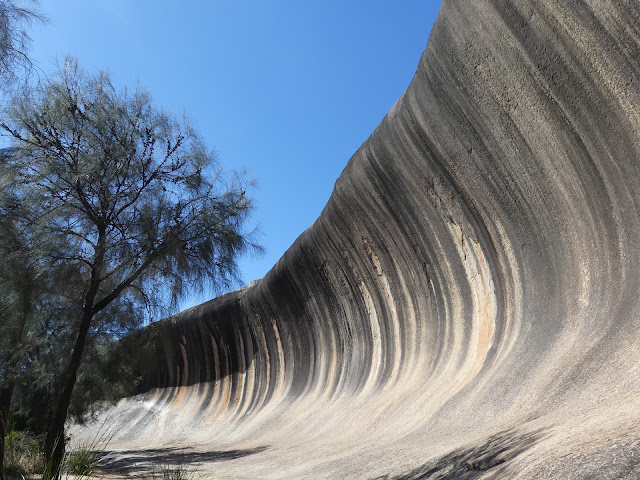
From Kelleberrin we drove down to Wave Rock, a wonderful natural
formation:
It's part of a huge outcrop of granite. As well as being a scenic wonder it is used to collect water, via a series of crude rock walls that direct the flow into a sizeable lagoon:
Our next stop was at one of the family farms, down near Mount Barker. We
stayed there three nights and got a thorough immersion in the day-to-day
running of the place. They grow canola, wheat and clover (as a a fallow crop,
to plough into a soil that basically consists of granite-based gravel and an inch
or two of sand), as well as sheep – for meat and wool.
 |
| We arrived after harvesting, and right after the stubble-burning - the peaks of the Stirling Range in the background |
 |
| Not exactly a view of Albany, but we were able to see ships at anchor outside the harbour |
 |
| It was almost impossible to get the whole of Albany in a single shot, but this gives you an idea - of a modest sized place scattered around a series of natural harbours |
 |
| We got lucky at Bluff Knoll. The peak was obscured all morning, but as we made the last few hundred yards the clouds were swept away, leaving us with superb views |
We were due to fly home from Perth, after rounding up a couple more cousins who took us out to the Botanic Gardens, from where you get a wonderful view of the city.


No comments:
Post a Comment
I like to hear what people think about my blog. Please add a comment if you are in the mood.